


Brazilian Highway network
Brazilian Highway network
SERVICES: Geometric - Topographical survey of the roadway
CUSTOMER: Gruppo Ecorodovias
YEAR: 2013
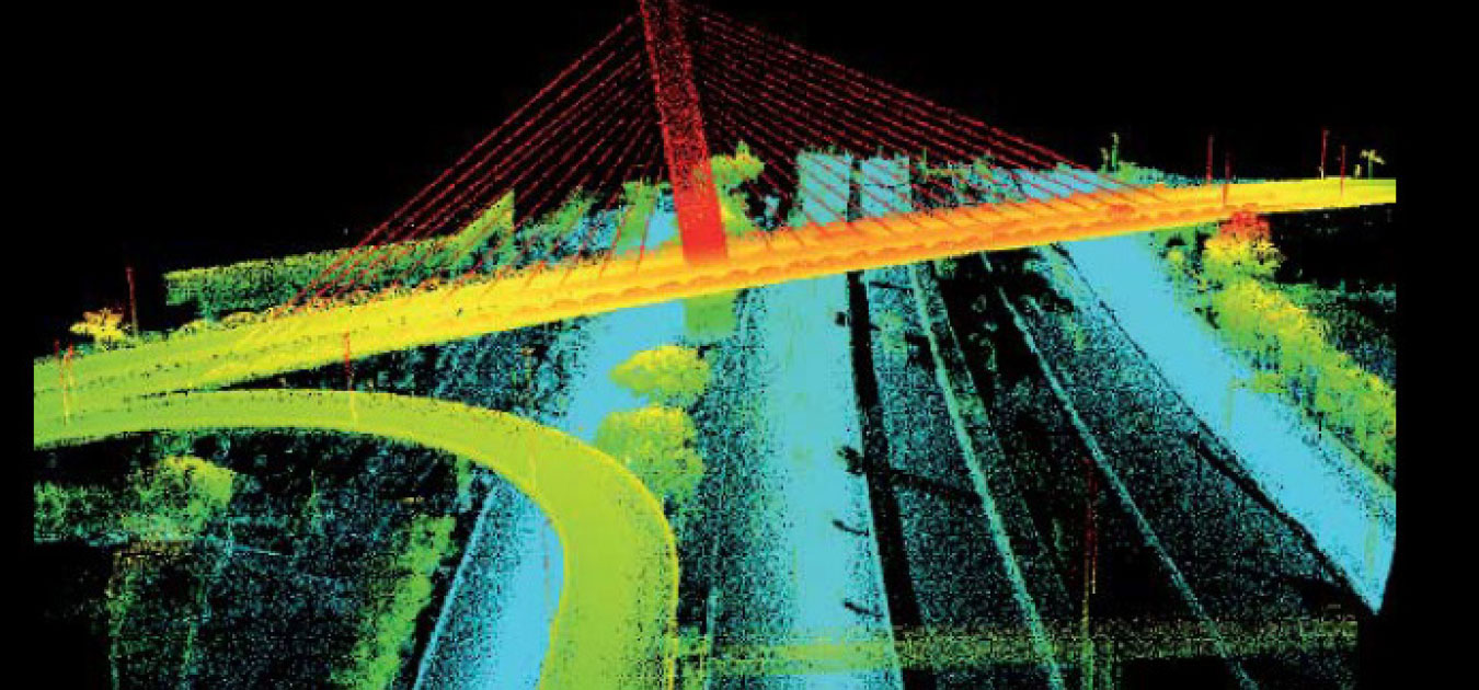
Survey of the highway network managed by the Brazilian license holder Ecorodovias with the aim of creating a 3D digital model to be used as a support for projects to upgrade the highway platform, maintenance and new projects.
Thanks to the tools used, namely the Lynx Mobile Mapper dynamic laser scanner, it was possible to survey about 2,200 km of highway in just 16 days of operation, acquiring over 1.5 TB of laser data and a database of 2,650,000 high-definition geo-referenced images.
The technology enabled rapid geo-referenced measurements by an Applanix LV420 POS positioning system, with accuracy comparable to topography, at a rate of over 400,000 points per second, resulting in high-density 3D laser point clouds of the infrastructure, including interchanges and highway artwork.